Location and how to find St. Andrew's United Church in Williams Lake, BC


Click on this link to see a map by Google Street View of St. Andrew's United Church
. .
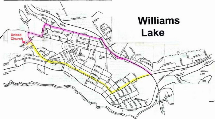
From Highway 97:
From the 'Y'(junction of highways 97 & 20) travel towards Quesnel, after light and one block, turn left
onto 11th Avenue, travel 4 blocks to a 4-way stop, go straight for 1 block, turn left onto Blair Avenue, travel to the end of the street, turn right onto Western Avenue,
travel 1 block to a 4-way stop, turn left onto Midnight Avenue, travel 1 block, turn right onto Huckvale Place
and you will see the church on your right.
From Downtown:
On Oliver(main Street), turn right onto 2nd Avenue at CIBC, travel 10 blocks to 4-way stop,
go straight(the street name changes from 2nd Ave to Midnight) travel for 5 blocks, turn left near the top of the hill
onto Huckvale Place and you will see the church on your right.
![]()